500 signatures reached
To: Transport Scotland, Douglas Ross MP, Richard Lochhead (Highlands and Islands MSP), Humza Yousaf (Transport Secretary Scotland)
Encourage Transport Scotland to rethink the A96 dualling options from Brodie to Forres.

Reconsider the proposed routings shown by Transport Scotland between Hardmuir and Forres for the A96 dual carriageway.
Why is this important?
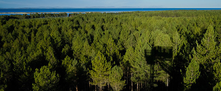
Transport Scotland has made available its proposed routes for the A96 dual carriageway from Hardmuir to Fochabers. The purple route P1 is shown to go directly through Macbeth's Hillock - a site that legend has it is where Macbeth and Banquo met the witches who told them their fate. It then travels east through Brodie Home Farm, immediately adjacent to Brodie Castle (a Scottish Tourist Board four star and Gold Green Tourism Award Winner property), owned and managed by the National Trust for Scotland who describe it as the "Ancestral home of Clan Brodie, with an outstanding art collection and magnificent library". The route then moves north and skims along the edge of Culbin Forest, an area designated as a Site of Special Scientific Interest (SSSI). The Forestry Commission notes that "The diverse landscape and unusual species here have achieved national and international recognition and are protected by law". The RSPB calls it "A breathtaking coastal reserve, full of wildlife". It then crosses the Moray Coastal Trail which allows locals and tourists alike to enjoy "a coastline alive with wildlife that would be the envy of many other regions in Britain". What is the value placed on the detrimental impact to so many of the wonderful historical assets of this area?
Quite apart from the significant environmental and ecological delights that this option destroys, it cuts the close-knit rural communities of Dyke, Kintessack, Moy and Loanhead right down the middle. All the children from this area go to school in Dyke Village School, and the Village Hall and Church are the epicentres of activity for this community. It destroys the homes of people who have lived in this community their whole lives and obliterates the tranquility and beauty of those who remain there. What is the value placed on the destruction of a community?
This is an area frequented by cyclists, bird watchers, anglers, horse-riders and walkers with its wide network of quiet, beautiful roads and tracks. It is a key attraction for tourists. What is the value placed on the destruction of our local economy, with tourism, self-catering accommodation, farming and a wealth of local businesses?
From a practical point of view, the proposed route crosses, not once, but at least twice, the Gas Pipeline and Storage System that runs from Inverness to RAF Lossiemouth. It spends a significant amount of time in areas designated as medium or high risk of flooding on the SEPA flood maps. What is the cost of this proposed route through land patently unsuitable for anything other than birds, animals, people and water?
Please lend your support to this petition asking Transport Scotland to reconsider it's proposal and exclude this as a potential route for the A96 dual carriageway.
